Reading the Valley Without a Screen: Landmarks That Guide You Around Chenies
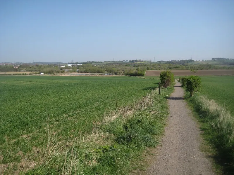
Photo: Mike Kirby , CC BY-SA 2.0, via Wikimedia Commons
There is a particular kind of walker who arrives at a Buckinghamshire footpath with a route loaded on a screen, a battery warning at 34 per cent, and no idea which way is north. I have been that walker. Then I started walking the Chess Valley properly, and discovered that the valley is one of the best places in the county to leave the map at home — provided you learn to read it the old way.
This is a guide to that reading. Not a turn-by-turn route, but a toolbox of landmarks that actually mean something on the ground, plus honest notes on the months when the ground stops cooperating.
Why the Phone Stays in the Pocket
Two reasons, one practical and one not. Practically, the valley floor between Chenies and Latimer eats signal in a way that feels almost personal, and nothing ruins a good walk faster than a route arrow spinning in an empty field. Less practically, walking by landmark changes the walk. You notice more. You start registering the shape of a hedge the way you register a familiar face.
The Landmarks That Actually Work
The church tower. From most of the valley floor, the tower of St Michael's sits above the trees like a fixed point in a moving world. Lose your bearings on the lower path and it will tell you whether you are facing up-valley or down. It is the single most useful thing in the parish.
The kissing gates. Count them. This sounds trivial; it is not. On the Chess Valley Walk they arrive in a fairly reliable sequence, and knowing that you have passed the fourth means you are roughly where you think you are, even if the field edge looks entirely different from the way it looked in April.
Stiles on the higher paths. The stiles up towards the top of the village and along the field boundaries mark the transition from valley floor to open farmland. If the ground underfoot has changed from soft to greasy, you have climbed, and you should probably be looking for a hedge gap rather than a gate.
Field boundaries. The best navigators in the valley are the hedgerows. Where a hedge runs away from the river at a right angle, there is almost always a right of way tucked into its corner. If you find yourself walking parallel to a hedge for a long stretch with no gap on your left, turn around — you have drifted off the line.
The river handrail. The Chess is small enough to be crossed without getting wet and continuous enough to follow. Treat it as a handrail when nothing else makes sense. It will not take you the shortest way, but it will take you a way.
A Route Sketch, Roughly Six Miles
Start on the village side, drop down to Chenies Bottom, and cross the Chess. Pick up the valley path and head roughly north-west, following the river — the walking here is flat and forgiving, which is why it makes such good winter ground. Near Latimer, turn uphill and take the higher field paths back through the edge of the woods rather than retracing your steps along the water.
From the top of the rise, the village announces itself long before you reach it: the church, then rooftops, then the lane. Drop back into Chenies and you are done.
I have deliberately not given you field numbers or track names. The exact line shifts with the crops, and a route written down in one season can be nonsense in another. Walk the shape of it instead: down, along the river, up, back over the top.
When the Path Disappears: The Muddier Months
From roughly November to March, some of these paths stop being paths and become suggestions. Three things help.
First, walk the valley floor and save the higher fields for a drier day. The river path holds up far better than the chalk-and-clay slopes above it.
Second, trust the gates over the ground. If the mud fans out in three directions, the true line is almost always to the left or right of the worst of it, following the fence, not through the middle.
Third, accept one wet foot. Every attempt to stay perfectly dry on a January footpath around here ends with a worse outcome than simply committing.
Where the Signage Lets You Down
Not all waymarking is equal. The valley path itself is generally well signed, and the yellow waymark discs are a welcome sight. The problems come at the joins: the moment you leave the river and head uphill, the markings thin out, and there are junctions where a fingerpost points confidently into a gap that has not been used by anyone since the summer.
Two specific weak spots worth knowing. Where the higher paths meet the lanes above the village, direction is often a matter of guesswork, so it is worth deciding your exit point before you start climbing. And where the route crosses arable fields, the reinstated path can arrive a field's width from where the map suggests — follow the trodden line, not the theory.
What to Carry Instead
A pocket compass, a paper extract of the OS map if you want the safety net, water, and the willingness to walk back the way you came without treating it as a failure. Add a head torch in winter, since the valley floor gets dark astonishingly early in December.
Most of all, carry the habit of looking up. On the paths around Chenies, the answer is nearly always on the skyline — a tower, a hedge line, a gate, a gap. The valley is a good teacher, and it does not need your battery.